Between dawn and dusk -$295/mo
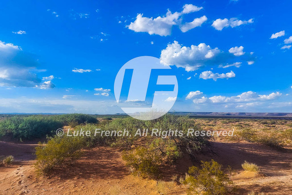
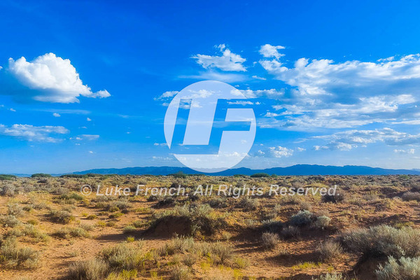
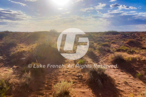
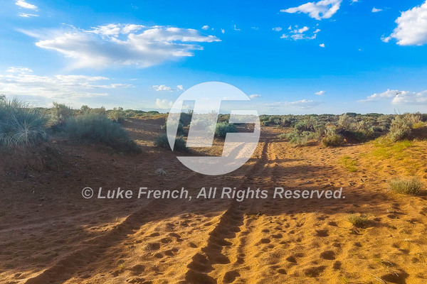
Enjoy 20 plus acres of untouched land in Hudspeth County, Texas near Fort Hancock. A beautiful backdrop of mountain peaks and Desert Landscape is conveniently located in the northwest corner of Texas, close to both the Mexican and New Mexican borders.
Fort Hancock started as a military camp in the late 1800’s, named after General Winfield Scott.
Hudspeth County is named for Claude Benton Hudspeth, a state senator and United States Representative from El Paso. The area was a pass through as explorers looked for routes between Texas and California Hudspeth County was formed in 1917 from El Paso County, Texas.
Seize the day & click the green "Contact the Seller" button to get in touch with us for more details on this property.
PRICE:
Owner Financing Available:
$500 down (plus the $250 doc fee)
$295/mo for 96 months
Seize the day & click the green "Contact the Seller" button to get in touch with us for more details on this property.
PROPERTY DETAILS:
SUBDIVISION: SUNSET RANCHES UNIT 109
STREET ADDRESS: N/A, near Fort Hancock, TX 79839
STATE: TX
COUNTY: Hudspeth County, TX
ZIP: 79839
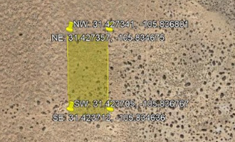
SIZE: 20.01 acres
LOT DIMENSIONS: 664 feet x a335 feet
LEGAL DESCRIPTION: TRACT(S) #19, SECTION 46 BLOCK 075 SURVEY TP TWP (if applicable) 5 HUDSPETH COUNTY, TEXAS. A total of 20 acres. Unit 109Surveyor's DescriptionA parcel of land being a portion of Section 46, Block 75, Township 5, T & P RR Surveys, Hudspeth County, Texas, also known as Tract 19, SUNSET RANCHES UNIT ONEHUNDRED NINE, and more particularly described by metes and bounds as follows:COMMENCING for reference at the common corner of Sections 2 & 3, Block 75, Tsp. 6, and Sections 46 & 47, Block 75, Township 5, found marked by a 2-1/2” galv. iron pipe; thence, North 00 deg. 37 min. 47 sec. West with the west line of said Section 46 for a distance of 1336.61 feet to a ½” rebar with cap “RPLS 4680” set; thence, South 89 deg. 48 min. 28 sec. West for a distance of 3286.62 feet to a ½” rebar with cap set, said rebar is the SE corner and POINT OF BEGINNING of this parcel description;THENCE, South 89 deg. 48 min. 28 sec. West with the centerline of a 60 foot wide easement for a distance of 658.22 feet to a ½” rebar with cap set for the SW corner of this parcel;THENCE, North 00 deg. 39 min. 51 sec. West for a distance of 1324.24 feet to a ½” rebar with cap set for the NW corner of this parcel;THENCE, North 89 deg. 48 min. 28 sec. East for a distance of 658.22 feet to a ½” rebar with cap set for the NE corner of this parcel;THENCE, South 00 deg. 39 min. 51 sec. East for a distance of 1324.24 feet to the POINT OF BEGINNING of this parcel.Said parcel contains 20.009 acres, more or less.Said parcel is subject to a 30 foot wide road easement lying adjacent and parallel to the S’ly boundary line which contains 0.453 acres, more or less.
ELEVATION: 4,010 ft
ANNUAL TAXES: Approx. $250.00 per year
ZONING: None -
FLOOD ZONE: Unsure
HOA/POA: No
IMPROVEMENTS: None
ACCESS: There is a trail on the southern portion of the lot.
WATER: Would be a well, water haul and holding tank or other similar option
SEWER: Would be by Septic
UTILITIES: Power by solar, wind or generator, Phone by cellular, satellite TV/Internet/Phone
Seize the day & click the green "Contact the Seller" button to get in touch with us for more details on this property.
#00436
Posted By